AMR and AGV are useful operating descriptions, but they are not mutually exclusive engineering standards. A traditional AGV often follows a constrained route defined by guides or infrastructure, while an AMR usually localizes in a map and can plan around obstacles within an allowed area. Many products combine both behaviors.
The right choice depends on material flow, route changes, intersections, people, floor conditions, fleet authority, recovery and support. More onboard autonomy can reduce fixed guidance but adds perception, mapping and behavior that must be commissioned. A constrained route can simplify validation but may require costly site changes.
Use this guide with the logistics AI system guide and VDA 5050 Version 3 guide. Define one operating contract and measure throughput under realistic traffic before comparing labels.
Describe the route and responsibility, not the marketing name
Draw pickup, travel, handoff and charging zones with intersections, clearances, doors, elevators, pedestrian access and floor constraints. State which deviations a vehicle may choose and which paths are prohibited. The map becomes an operating boundary rather than a navigation screenshot.
Assign responsibility for localization, route choice, traffic control, task priority, site signaling and exception recovery. A vehicle may plan locally while a central fleet manager reserves zones. Another may receive an exact path. These architectures matter more than whether a brochure says AMR.

Constrained guidance favors repeatability
A line, wire, reflector, magnetic marker or virtual route can make vehicle behavior easier to predict and can work well for stable repetitive material flow. Site infrastructure and commissioning encode the allowed path. Changes may require physical work, new validation or production downtime.
Constrained does not mean primitive. AGVs can use localization, obstacle detection and sophisticated traffic control. Conversely, an AMR may be intentionally restricted to fixed corridors. Compare actual navigation modes and recovery rules.
| Decision axis | Constrained-route approach | Freer-navigation approach | Evidence needed |
|---|---|---|---|
| Route change | Infrastructure or map update | Map and behavior update | Change validation |
| Obstacle | Stop or limited bypass | Local replan if allowed | Recovery time |
| Traffic | Central reservation | Central plus local planning | Deadlock tests |
| Environment | Stable landmarks or guides | Perception-rich map | Localization robustness |
| Integration | Defined stations | Flexible goals and zones | Interface profile |
AMR autonomy moves more decisions onboard
A typical AMR uses map-based localization, perception and local planning to move through allowed free space. It can adapt to a blocked aisle when an alternate route exists and policy permits it. It cannot create safe clearance, open an unintegrated door or bypass a prohibited area.
Localization quality depends on geometry, lighting, sensor visibility and environmental change. Forklifts, pallets and temporary walls can alter the scene. Define localization confidence, lost-position behavior and map governance before treating route flexibility as automatic.
Autonomy exists on a continuum
One vehicle may follow a fixed route in production, use local avoidance around people and switch to manual recovery. Another may choose freely inside a zone but receive centrally reserved corridor segments. Capture these modes in a responsibility matrix.
Mode transitions are often where incidents and downtime occur. Test startup, localization recovery, map change, manual towing, maintenance and return to automatic service. Operators need visible state and a clear authority handoff.
Fleet control allocates tasks and traffic authority
The fleet manager may assign jobs, choose vehicles, reserve intersections, coordinate chargers and negotiate with warehouse or manufacturing software. Vehicle controllers enforce local motion and obstacle response. An unclear boundary can create two planners fighting over the same route.
Define source of truth for map, order, state, traffic block and completion. Include stale messages, duplicate orders and controller restart. The interface must support reconciliation after disconnection rather than assuming every message arrives once and in order.
| Function | Vehicle | Fleet manager | Site system |
|---|---|---|---|
| Local collision avoidance | Primary | Constraints | Site layout |
| Job allocation | Status input | Primary | Demand source |
| Intersection reservation | Request | Primary | Signal interface |
| Station readiness | Approach state | Coordination | Equipment state |
| Recovery | Safe local state | Replan or reassign | Operator workflow |
VDA 5050 standardizes a communication boundary
VDA 5050 defines order and state exchange between master control and mobile robots. The current official VDA 5050 page identifies Version 3.0.0. A specification version, schemas and implementation profile should be pinned for every project.
Support for the standard does not guarantee plug-and-play operation. Coordinate systems, optional features, actions, errors, charging, security and vendor extensions require agreement and cross-vendor testing. The interface does not replace navigation or safety validation.
Safety follows hazards, not the AMR or AGV label
The ISO 3691-4:2023 page covers safety requirements and verification for driverless industrial trucks and explicitly includes terms such as AGV and AMR. Apply the relevant standards, local law and risk assessment to the complete truck system and operating zone.
Test protective-field detection, stopping distance, speed limits, load stability, visibility, restart, manual mode and foreseeable obstruction. Safety scanners do not make a poor intersection or falling load safe by themselves. Site preparation and operating rules remain part of risk reduction.
Throughput is determined by conflict and waiting
Top speed matters only on uncongested travel. Real throughput includes dispatch delay, blocked aisles, intersection queues, pickup alignment, equipment handshake, charging and manual recovery. Measure completed deliveries per hour and the distribution of cycle time.
Simulate and then stage realistic demand peaks, narrow aisles and mixed vehicle types. Add one vehicle at a time. More robots can reduce throughput when reservation zones are too coarse or deadlock recovery is weak.
Specify exceptions before choosing technology
List blocked routes, dropped loads, unreadable markers, lost localization, occupied stations, closed fire doors, low battery, network loss and disabled vehicles. For each, state detection, safe state, automatic retry, operator action and evidence required to resume.
An AMR may route around a pallet but still stop at a human-created bottleneck. An AGV may recover rapidly when a fixed guide makes position unambiguous. Compare recovery minutes and support effort, not only nominal autonomy.
Model lifecycle cost and change cost separately
Include vehicles, guides, maps, wireless coverage, traffic control, station integration, safety engineering, commissioning, training, spares, software subscriptions and support. Infrastructure-heavy designs may be economical over a stable long life. Flexible maps may pay off when routes change often.
Estimate the cost and downtime of a representative route change. Also include validation and retraining, because a digital edit can still alter safety and throughput. Use the warehouse picking system guide to keep vehicle economics connected to end-to-end material flow.
Run a zone-level acceptance test
Select one representative zone and execute normal, peak and failure scenarios with production interfaces. Record task completion, travel and wait time, traffic conflicts, localization interventions, protective stops, charging and operator minutes.
Repeat after map, fleet software or layout changes. Archive versions and event logs. The selected system should meet a defined service level with recoverable failures, not merely finish a clean demonstration run.
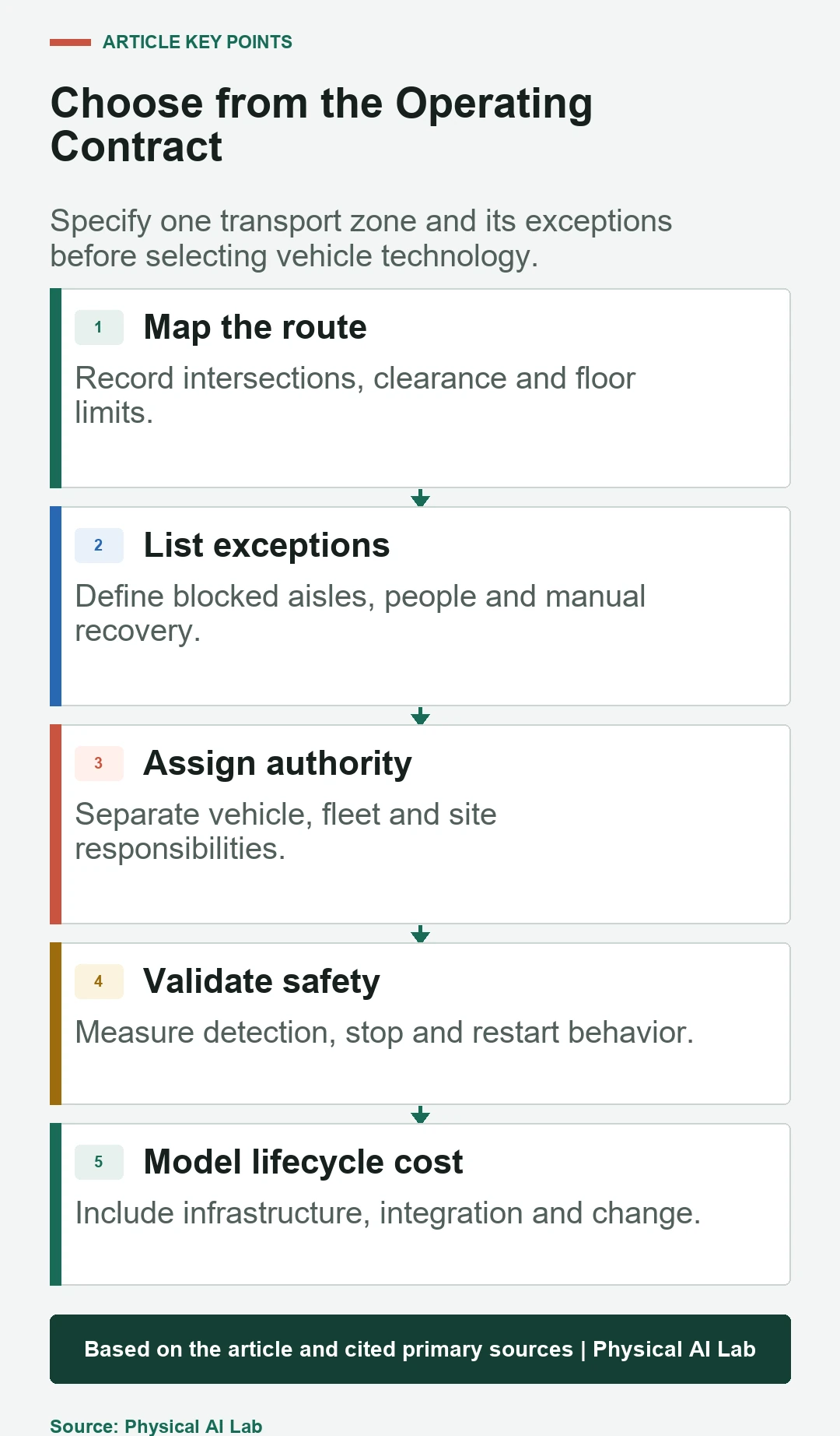
- Map routes, zones, interfaces and exceptions.
- Assign vehicle, fleet and site authority.
- Validate safety under the actual operating zone.
- Measure cycle-time tails and recovery effort.
- Include infrastructure and change in lifecycle cost.
Frequently asked questions
Will an AMR always drive around an obstacle?
No. It needs a valid alternative route, sufficient clearance, localization and policy permission. Otherwise stopping can be the correct behavior.
Must an AGV follow magnetic tape?
No. AGVs can use wires, reflectors, natural features, virtual paths and other guidance. The key distinction is the actual route and decision architecture.
Does VDA 5050 make different vendors plug and play?
No. It defines a broad interface. Projects still need a pinned version, implementation profile, map conventions, actions, errors, security and interoperability tests.
Is an AMR always more expensive?
Not necessarily. Vehicle price, site infrastructure, route-change frequency, integration, support and downtime determine lifecycle cost.
Does a safety LiDAR finish the risk assessment?
No. Load, speed, stopping, intersections, site conditions, restart and human behavior still need system-level assessment and validation.
Mobile-Robot Selection Boundary
Mobile-robot selection and safety depend on the complete vehicle, fleet controls, payload, interfaces and operating zone. Apply current standards and qualified risk assessment to the deployed system.